
What Are GPS Ground Stations and How Do They Maintain Satellites?
- 01GPS ground stations monitor, correct, and control every satellite in orbit
- 02The Master Control Station in Colorado is the brain of the entire system
- 03Monitor stations track satellite signals from fixed points around the globe
- 04Ground antennas send correction commands directly back up to the satellites
- 05Without ground stations, GPS accuracy would drift and eventually fail
As an Amazon Associate, Konnect GPS earns from qualifying purchases.
What Are GPS Ground Stations and How Do They Maintain Satellites?

You pull out your phone, open a map, and your location appears within seconds. Most people credit the satellites for that. Satellites alone cannot keep GPS working, though. They need constant help from the ground.
I'm Ryan Horban, a GPS tracking expert with more than 15 years of hands-on experience testing vehicle tracking systems for families, fleets, and businesses. One question I rarely hear but should hear more often is this: who is actually keeping those satellites accurate? The answer is GPS ground stations, and without them the entire system would slowly drift into uselessness.
In this guide, I'll explain what GPS ground stations are, how they work, where they are located, and why they matter every time you use a GPS tracker, navigation app, or any location-based service.
GPS ground stations are land-based facilities that continuously monitor, correct, and communicate with GPS satellites orbiting Earth. They track each satellite's position and clock, calculate any errors, and upload correction data to keep the system accurate. Without ground stations, satellite clocks would drift and orbital paths would shift, making GPS positioning unreliable within days.
The Three Segments of GPS
To understand what ground stations do, you first need to know that GPS is built on three separate parts working together. The U.S. Space Force calls them segments.
The space segment is the constellation of satellites orbiting Earth at an altitude of roughly 12,550 miles above the surface. These satellites broadcast the signals your device receives.
The control segment is the network of ground stations around the world. This is the part most people never hear about, and it does three jobs: it monitors satellites, detects errors, and sends correction data back up.
The user segment is every device that receives GPS signals, including your phone, your car's navigation system, and any GPS tracker you use.
Most GPS explanations focus only on the space segment and the user segment. The control segment holds the whole system together and is the most complex of the three.

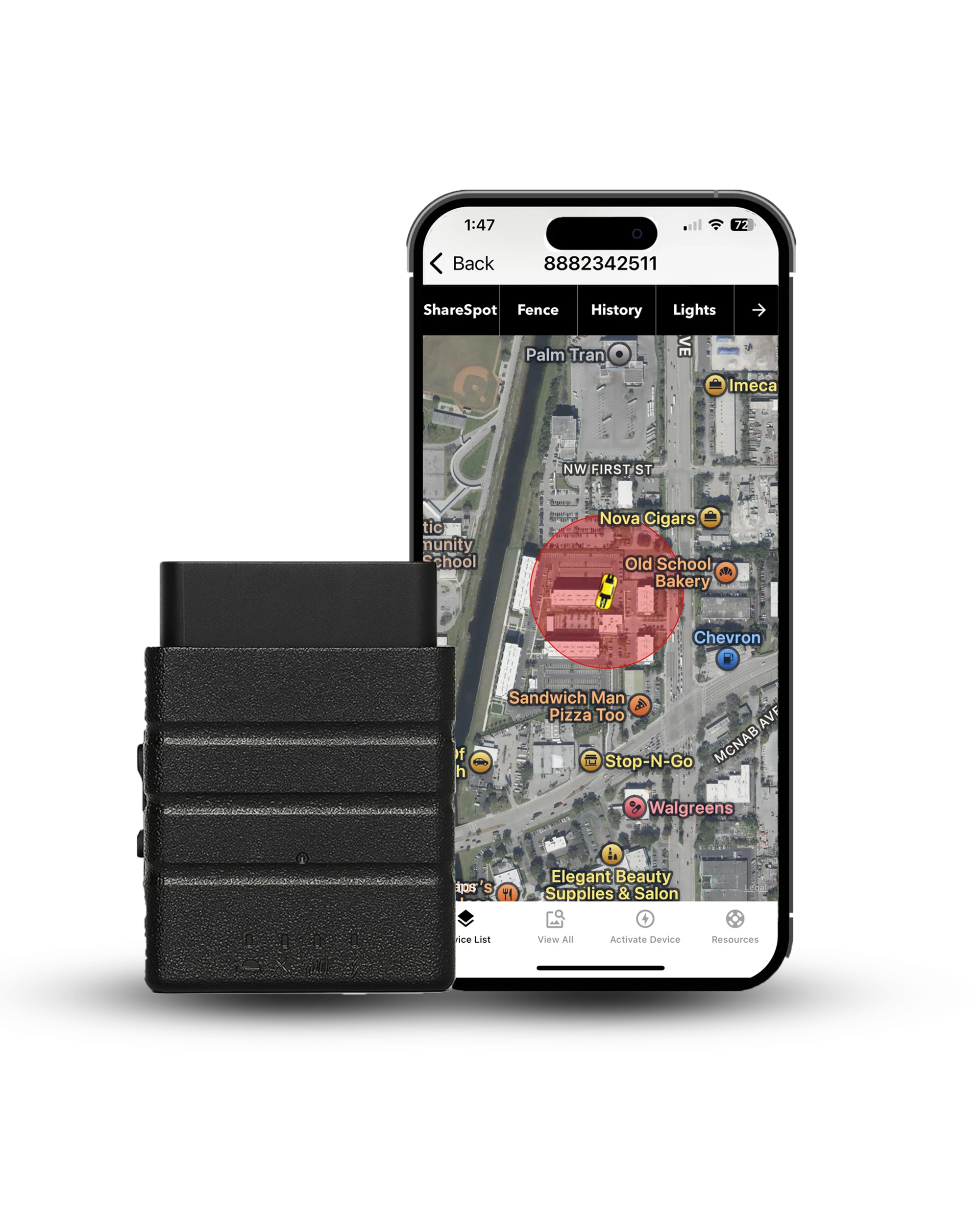
A user-segment device that puts all that corrected satellite accuracy to work: real-time position every 3 seconds, 20x the once-a-minute industry norm.
- 3 second updates
- 150+ countries
- Geofence and speed alerts
- Tamper alerts
- Lifetime warranty
- USA based support
What Are GPS Ground Stations?
GPS ground stations are fixed land-based facilities that communicate with GPS satellites and keep them functioning correctly. They are part of what the U.S. Space Force officially calls the Operational Control System, or OCS.
Ground stations serve three main functions: they listen to satellite signals to check for errors, calculate corrections when errors are found, and transmit those corrections back up to the satellites.
A satellite in orbit is like a clock attached to a moving platform 12,550 miles above Earth. Gravity changes slightly at different orbital positions. Radiation from the sun pushes the satellite off course. The onboard atomic clock drifts by a few nanoseconds each day. None of those problems fix themselves. Ground stations exist to catch and correct all of them before they affect your position fix.
The Three Types of Ground Stations
The GPS control segment uses three different types of ground facility, and each one plays a specific role.
Master Control Station

The Master Control Station, known as the MCS, is the central hub of the entire GPS control segment, located at Schriever Space Force Base in Colorado Springs, Colorado.
The MCS receives tracking data from all monitor stations around the world, processes that data, calculates any errors in satellite orbits or clocks, generates correction messages, and sends those corrections to ground antennas for upload to the satellites.
Every GPS satellite in orbit receives its instructions from the Master Control Station. If there is a software update for a satellite, the MCS handles it. If a satellite drifts out of its assigned orbital slot, the MCS commands a correction. If a satellite's clock needs adjustment, the MCS calculates the fix and uploads it.
There is also a backup facility called the Alternate Master Control Station, located at Vandenberg Space Force Base in California. If the primary MCS in Colorado goes offline for any reason, the backup takes over without any interruption to GPS service.
Monitor Stations

Monitor stations are unmanned receiver stations placed at fixed, precisely known locations around the globe. Their job is to continuously receive signals from every GPS satellite passing overhead and measure those signals with extreme precision.
Each monitor station records the exact timing of signals from every satellite it can see, then compares what it receives to what it should receive based on the satellite's known position and clock. Any difference, no matter how small, gets recorded and sent to the Master Control Station for analysis.
Because monitor stations sit at known fixed coordinates, any error in a satellite's signal shows up clearly against that fixed reference. If a satellite's clock is running four nanoseconds fast, the monitor stations detect it. If a satellite has drifted 50 meters from its published orbital position, the monitor stations catch it.
The current control segment operates 17 monitoring sites positioned around the world, with a concentration near the equator to maximize satellite visibility. Locations include sites in Colorado, Hawaii, Ascension Island, Diego Garcia, Kwajalein, Cape Canaveral, Washington D.C., England, Ecuador, Argentina, Bahrain, Australia, and South Korea, among others.
Ground Antennas

Ground antennas, also called dedicated uplink antennas or ground control antennas, are the communication link between the Master Control Station and the satellites themselves.
After the MCS calculates the corrections needed, it routes those corrections to the nearest available ground antenna. The antenna transmits the data directly to the satellite using an S-band radio signal. The satellite receives the upload, stores the correction data in its onboard navigation message, and begins broadcasting the updated information to receivers on the ground.
GPS operates 4 dedicated ground antennas, at Ascension Island, Diego Garcia, Kwajalein, and Cape Canaveral, alongside 7 Air Force Satellite Control Network remote tracking stations. Together those make up the 11 command and control antennas in the current control segment. Corrections are uploaded to each satellite at least once every two hours under normal conditions.
How Ground Stations Maintain GPS Satellites
Ground stations perform three types of maintenance on GPS satellites continuously, every day, without stopping.
Clock Corrections

Every GPS satellite carries atomic clocks accurate to within a few nanoseconds. Even atomic clocks drift slightly over time due to the effects of gravity at orbital altitude, temperature changes, and radiation exposure. Because a radio signal travels roughly 300 meters every microsecond, a clock drift of just one microsecond produces a position error of around 300 meters for anyone using that satellite's signal.
Monitor stations detect clock drift by comparing signal arrival times against their known fixed positions. The Master Control Station calculates the exact correction value needed and uploads a clock adjustment to the satellite. The satellite's navigation message is then updated so receivers on the ground can apply the correction automatically. This process happens every few hours for every satellite in the constellation.
Orbit Corrections

GPS satellites do not travel in perfectly stable orbits. The moon's gravity tugs them slightly off course. The sun's radiation pressure pushes them. The non-uniform distribution of Earth's mass creates gravitational variations that slowly alter orbital paths. Even the solar wind has a measurable effect over time.
If a satellite drifts from its assigned position in the constellation, the geometry of the satellite network changes. Satellite geometry directly affects position accuracy, so a satellite in the wrong place produces worse intersection angles, which means worse accuracy for users on the ground.
Monitor stations track each satellite's actual orbital path against its predicted path. When a drift is detected, the Master Control Station uploads a maneuver command to the satellite, which fires small onboard thrusters to nudge itself back into the correct orbit. These orbital corrections are performed regularly throughout each satellite's operational life, which typically runs 10 to 15 years.
Navigation Message Updates

Each GPS satellite continuously broadcasts what is called a navigation message. This message contains the satellite's precise orbital parameters, its clock correction values, its health status, and data about the rest of the constellation called almanac data. Receivers use all of this information to calculate position.
If the navigation message contains outdated or incorrect data, every receiver relying on that satellite gets degraded or wrong position information. The Master Control Station generates updated navigation messages every two hours and uploads them to each satellite through the ground antennas. The satellite stores the updated message and begins broadcasting it immediately.
This is also how the control segment handles satellite health flags. If a satellite develops a hardware problem, the MCS can flag that satellite as unhealthy in its navigation message. Receivers automatically exclude unhealthy satellites from their calculations, which prevents bad data from corrupting position fixes.
Where Are GPS Ground Stations Located?

GPS ground stations are distributed around the world to ensure that every satellite in the constellation passes over at least one monitoring station during each orbit. Since GPS satellites orbit at about 12,550 miles and complete two full orbits every 24 hours, a globally distributed network guarantees continuous coverage of the entire constellation.
The U.S. Space Force has expanded the ground control network significantly since GPS was first deployed. Early GPS operated with far fewer monitor stations, which meant some satellites could go unmonitored for up to two hours per orbit. Today's expanded network keeps every satellite under observation at all times.
Key locations include the Master Control Station at Schriever Space Force Base in Colorado, monitoring and antenna facilities at Ascension Island in the South Atlantic, Diego Garcia in the Indian Ocean, Kwajalein Atoll in the Pacific, Cape Canaveral in Florida, and additional monitoring stations across Hawaii, the United Kingdom, Ecuador, Argentina, Australia, Bahrain, and South Korea.
This geographic spread is intentional. A satellite in equatorial orbit is visible from stations north and south of the equator simultaneously, meaning more stations can cross-check its signal at once.
How Often Do Ground Stations Communicate With Satellites?

GPS satellites receive updated navigation data from ground stations at least once every two hours. During that two-hour window, the satellite continues broadcasting using the most recently uploaded correction data.
For routine operations, two-hour update cycles are more than adequate. Satellite clocks drift slowly and orbital paths change gradually, so a two-hour-old correction is still accurate enough to maintain the few-meter position accuracy that standard GPS delivers.
For emergencies, such as a satellite clock suddenly behaving unexpectedly or a software anomaly being detected, the Master Control Station can contact any satellite within minutes through the nearest available ground antenna and upload an emergency correction, or command the satellite to broadcast an unhealthy status flag immediately.
What Happens If a Ground Station Goes Offline?

GPS is designed with significant redundancy at every level of the control segment.
If a single monitor station goes offline, other stations covering the same satellite trajectories continue tracking. The Master Control Station simply uses data from the remaining stations. Corrections may be slightly less precise for a brief period, but GPS service continues without interruption.
If the primary Master Control Station at Schriever Space Force Base were to go offline, the Alternate Master Control Station at Vandenberg Space Force Base in California would take over all operations. The switchover happens without any degradation to GPS service.
If a ground antenna becomes unavailable, corrections are routed through the nearest alternative antenna. Because satellites orbit continuously, a different antenna comes into optimal contact range within a short time window regardless of which one is unavailable.
GPS satellites can also operate autonomously for a limited period if all contact with the ground segment is interrupted, though accuracy slowly degrades as clocks drift and orbital parameters go stale the longer that gap lasts.
People buy a tracker on the strength of its update rate, which is fair. What almost nobody realizes is that the accuracy underneath that update rate is being maintained by a government ground crew every two hours, for free, forever.
Ground Stations and GPS Accuracy

The accuracy you experience when using a GPS tracker, navigation app, or any location-based service is directly tied to how well the control segment is doing its job.
Without regular clock corrections from ground stations, satellite clock drift would introduce position errors of hundreds of meters within days. Without orbital corrections, the geometry of the satellite constellation would degrade, making trilateration less precise. Without navigation message updates, receivers would be working from stale data that no longer accurately represents each satellite's true position.
The few-meter accuracy that standard GPS delivers under open-sky conditions exists because ground stations are continuously correcting and maintaining every satellite in the constellation. That level of accuracy is not a property of the satellites themselves, but the result of a continuous, coordinated effort between satellites in space and ground stations on Earth.
For vehicle GPS tracking, that accuracy means a tracker like the Konnect OBD2 can show a vehicle's position within a few meters, identify which road it is on, calculate speed accurately from position updates, and trigger geofence alerts when a vehicle crosses a defined boundary. All of that depends on the control segment keeping the satellite signals honest.
The satellites are corrected every two hours. Your tracker should keep up. Konnect reports position every 3 seconds against an industry norm of once a minute, on a flat monthly plan with no contract.
Get $10 Off KonnectRecent Upgrades to the GPS Ground Control Segment

The GPS control segment is not static. The U.S. Space Force has been upgrading it continuously since GPS became operational.
The most significant recent upgrade is the Architecture Evolution Plan, or AEP, which updated the Master Control Station's software and hardware. Before AEP, the MCS could only upload navigation data to satellites through the four dedicated ground antennas. After AEP, the MCS gained the ability to route uploads through a wider network, including remote tracking stations operated as part of the Air Force Satellite Control Network.
Another major upgrade is the Next Generation Operational Control System, known as OCX. This is a complete redesign of the GPS ground control software built to support the newer GPS III satellites, which carry more advanced signals and additional capabilities. OCX also incorporates stronger cybersecurity protections compared with the legacy control system.
These upgrades matter for everyday users because they improve the frequency and accuracy of corrections sent to satellites, which translates directly into better position accuracy on the ground.
GPS Ground Stations vs Cell Towers: Understanding the Difference

GPS ground stations and cell towers are both ground-based infrastructure, but they serve completely different functions in a GPS tracking system.
GPS ground stations communicate with satellites. They send and receive data that maintains satellite accuracy and keeps the constellation functioning correctly. They do not communicate with your phone, your GPS tracker, or any user device.
Cell towers communicate with your devices. In a GPS tracking system, cell towers carry the location data that a tracker has already calculated from satellite signals. They have no role in satellite maintenance.
Your GPS tracker receives satellite signals, runs trilateration to calculate position, and then uses the cellular network to send that position to a server where you can see it in an app. The accuracy of that position depends on the ground stations keeping the satellites corrected. The delivery of that position to your app depends on the cellular network.
Final Verdict
GPS ground stations are the part of the system that nobody talks about, and nobody could do without. Satellites broadcast signals and receivers calculate positions, but between those two steps a global network of monitor stations, ground antennas, and the Master Control Station works constantly to keep every satellite accurate.
Without ground stations, satellite clocks would drift by enough to make navigation unreliable within days. Orbital paths would shift out of the precise geometry needed for accurate trilateration. Navigation messages would go stale and feed receivers incorrect data about where satellites actually are.
Every time a GPS tracker shows a vehicle within a few meters of its actual position, that accuracy is the result of ground stations having corrected that satellite's clock and orbit in the hours before. The satellites get the credit. The ground stations do the work.
Sources
- GPS.gov, Control Segment, National Coordination Office for Space-Based Positioning, Navigation, and Timing
- GPS.gov, Space Segment
- GPS.gov, Architecture Evolution Plan (AEP)
- GPS.gov, Next Generation Operational Control System (OCX)
- Federal Aviation Administration, Satellite Navigation, GPS Control Segment
Konnect OBD2 plugs in once and turns corrected satellite signals into 3-second real-time location, accurate speed, and geofence alerts, across 150+ countries, with a lifetime warranty and USA-based support.
Some images in this article were generated using AI.
About the Author

 Buy on Amazon