
GPS Tracking For Wildlife
-
01
VHF, satellite, and GPS each solve a different problem, and many studies run more than one
-
02
Collar data has redrawn maps, funded wildlife overpasses, and changed where states allow development
-
03
Tags now start around 2 grams, which brought small birds into studies that once excluded them
-
04
Geofence alerts reach rangers before a herd reaches a village, turning records into prevention
-
05
Weight limits and mounting method are ethics questions first, and engineering questions second
I'm Ryan Horban. For the last 15 years I've worked with GPS vehicle trackers and fleet tracking systems. Wildlife tracking is a different world. The problems underneath it are not.
How often does the device report? How long does the power hold out? What happens when something crosses a line it shouldn't? Those three questions shape my week. They also shape a caribou study in the Arctic.
What follows is a plain walk through the field. What wildlife tracking is, why it changed conservation, and how researchers actually do the work. Every factual claim below links to where it came from.
What wildlife tracking isWhere it came from, and how it got from radio beeps to satellites.
Why it mattersTold through one migration route in Wyoming that ended in concrete.
The three technologiesVHF, satellite and GPS, and what each one is actually good for.
How a study runsFrom permits and capture through to published data.
What gets attachedCollars, harnesses, implants, and the contested rules on weight.
Where the data goesIncluding the geofence alerts that protect elephant herds.


Konnect OBD2 GPS Tracker
A research collar rations every fix to save battery. A tracker drawing power from your car has no such limit. Most trackers still report once a minute. Konnect reports every 3 seconds.
- 3-second updates, 20x faster
- Geofence and speed alerts
- 1 year of trip history
- Tamper alert when unplugged
- Lifetime warranty
- USA-based support
What Wildlife Tracking Actually Is
Telemetry
Measuring something from a distance and getting the reading back. The animal carries the instrument. The researcher reads it from somewhere else. Sometimes that means a hillside. Sometimes it means another continent.
The idea is old. Biologists began fitting animals with VHF radio transmitters in the 1960s. That worked, but it was hard labor. Someone had to walk the habitat with a receiver until the beeping got louder.
Satellites changed the arithmetic. NOAA and the French space agency CNES have run Argos since 1974. Its satellites circle the globe 14 times a day. Suddenly an animal could be tracked from orbit. Nobody had to be within earshot.
Early satellite transmitters were brutes. The first ones weighed 5 to 11 kilograms, which limited them to large mammals. Everything since has been a story about shrinking.
1970s, large mammals only
Late 1980s
Late 1990s
Today, small birds included
Then GPS arrived and flipped the relationship. Instead of the animal shouting upward, the tag listens. It works out its own position, then stores or sends it.
Why Any of This Matters
Here's the honest answer. Tracking data changes what governments are willing to protect.
Take one route in western Wyoming. In the late 1990s, nobody knew how pronghorn reached Grand Teton National Park from the Green River Basin. The animals vanished into the high country every spring. Where they went was a genuine mystery.
- 1998Researchers collar 35 pronghorn with VHF units. Biologist Hall Sawyer spends the following spring following tracks through snow and dirt with his dog.
- 2003GPS collars go on the Sublette Antelope Herd for the first time. The route can finally be mapped without anyone chasing it.
- 2008Bridger-Teton National Forest formally protects the corridor and names it the Path of the Pronghorn.
- 2013Wyoming's transportation department builds two overpasses and six underpasses on Highway 191. Pronghorn dislike underpasses, so the overpasses were a first for the state.
- 2026State-level protections for the Sublette Antelope Migration Corridor are announced, after years of contested review.
Timeline from Wyoming News coverage of the Path of the Pronghorn.
Read that sequence again. Thirty-five collars in 1998 eventually became concrete overpasses and a legal designation. That is the whole argument for this technology in one story.
The data also piles up. Movebank, hosted by the Max Planck Institute of Animal Behavior, is where much of it lives. Its public repository held 466 million locations from nearly 18,000 animals as of January 2025. The wider live database is far bigger again.
Archived animal locations in Movebank's public repository, covering 260 species and underpinning close to 400 peer-reviewed papers.
Source: Movebank Data Repository
The Three Technologies Behind Wildlife Tracking
Three approaches dominate. Picking between them comes down to three things. How far the animal ranges. How much the tag may weigh. Whether anyone needs the data today or in October.
VHF Radio
The oldest method still in daily use. A small transmitter pulses, and a researcher with a handheld antenna narrows in. Nothing beats it on cost or weight. The catch is obvious. Somebody has to be nearby, which makes covering ground slow and expensive.
Satellite Telemetry
The tag transmits upward. Polar-orbiting satellites work out where it was from the Doppler shift in that signal. Accuracy is coarser than GPS. Coverage is the trade you get in return, and it reaches everywhere. Argos now serves tags as light as 2 grams across roughly 3,500 bird species.
GPS
Here the tag receives rather than transmits. It computes its own fix from the GPS constellation, then stores or relays it. Accuracy tightens sharply and the track gets dense. Solar panels pushed the size down far enough for birds. The data still needs a way home.
| Technology | How it works | Best suited to |
|---|---|---|
| VHF radio tracking | A transmitter on the animal emits a signal. A researcher locates it by antenna, which means getting close. | Close-range work, and dense terrain where satellite signals struggle. |
| Satellite tracking | The tag transmits to orbiting satellites. Position is computed on the ground and relayed to the researcher. | Migratory species crossing oceans or continents, with no field team in range. |
| GPS tracking | A receiver on the animal calculates its own position, then stores or transmits the result. | Fine-grained movement studies, and with solar power, even small birds. |
Comparison adapted from New Hampshire PBS on wildlife tracking.
How a Tracking Study Actually Runs
Every project moves through the same five stages. A bull elephant and a migrating songbird share the sequence, if nothing else.
-
1Permits, then capture. Agencies license the capture and the tagging before anything happens. The animal is caught, handled, fitted, and released. This is the riskiest part of any study, and the part researchers work hardest to shorten.
-
2Collecting the data. The tag fixes its position on a schedule. Most units log a second stream alongside it. Temperature, activity, and on marine tags, dive depth.
-
3Getting it home. Data travels over a satellite or cellular link. Or it waits on the device until a team is close enough to pull it wirelessly. Or the tag has to be physically recovered.
-
4Reading the tracks. Analysts look for behavior, migration timing, and habitat use. The same file can feed a twenty-year corridor study and a same-day ranger callout.
-
5Publishing and archiving. Results go into papers, and increasingly into shared repositories. Naming a tracked animal and following its journey also builds the public support that funds the next season.
Money shapes all of it. A satellite transmitter runs several thousand dollars, plus annual data fees. Capture, permits, and field time land on top. A study with three tagged animals tells you about three animals.
What Gets Attached, and What It May Weigh
No single mounting method works across species. Get it wrong and the study measures its own interference.
Then there's weight, which is where the ethics live. The working guideline caps a tag at 3% of a bird's body mass, and around 5% for bats. So a 30-gram songbird gets a tag under a gram. Harness material counts toward that total.
Useful rule. Also, increasingly, a contested one.
A team led by Rory Wilson put accelerometers on collars across ten species, from koalas to cheetahs. They found the 3% figure ignores the forces a moving animal actually experiences. In four carnivore species, a compliant tag exerted force equal to 4 to 19% of body mass while moving. In a hunting cheetah, that peaked at 54%.
Mass is easy to measure. Force is what the animal feels. The field is still working out what to do about the gap.
Geofencing works the same way on your own vehicle. Draw a boundary, get a message when the car crosses it.
Shop KonnectWhere the Data Goes, and What It Prevents
A track sitting in a database is a research record. Push the same track through a boundary rule and it becomes a warning. That shift is the interesting part.
Three programs show the shift, at three different scales.
Save the Elephants
A virtual fence line gets programmed into the collar of a known crop-raiding elephant. Cross that line and the collar texts the reserve manager with a location. Staff reach the animal before it reaches a farm.
The animal that proved it
He was so destructive that managers had him in their rifle sights. Someone spotted the collar and called Save the Elephants first. Rangers turned him back each time an alert fired. By 2008 he had stopped raiding altogether.
WCS at Yankari Game Reserve
Six collared elephants let ranger teams shadow the herds continuously. Managers are alerted when an animal strays outside the reserve. Yankari holds Nigeria's largest remaining elephant population.
EarthRanger
An open-source system from the Allen Institute for AI that pulls in collar data and fires automated alerts. Animals entering a high-risk zone trigger a response, rather than a report written afterward.
How long Kimani raided crops in a single spree before geofencing was set up around him.
Where to Buy Research Grade Wildlife Trackers

Photo credit: telemetrysolutions.com
Consumer trackers are the wrong tool for this. Research work needs a device matched to a species and a data path that survives no cell coverage. This is a specialist market, and Konnect GPS points readers toward Telemetry Solutions for it.
The company has supplied wildlife biologists since 1996, out of Concord, California. Their range runs from about 5 grams to 200 grams. That covers small birds and reptiles at one end, large mammals at the other.
The surrounding kit
Base stations for field download, satellite upload devices, and drop-off mechanisms. Custom builds are available where nothing off the shelf fits a study.
On durability
One fox collar recovered after five years with 13,000 stored fixes. Wireless transfer to a base station at up to 30 kilometers. Both numbers come from Telemetry Solutions.
Telemetry Solutions
Custom wildlife GPS devices, base stations, and drop-off mechanisms, supplied to research teams worldwide since 1996.
Visit WebsiteUpdate interval decides everything in tracking. Battery life and mounting are just the constraints you accept to get the interval you need.
Ryan Horban, GPS Tracking Expert
What Wildlife Tracking and Vehicle Tracking Have in Common
Strip away the collar and the harness. Both fields are making the same three decisions.
Reporting interval against available power
A research collar might take one fix an hour. Sometimes one a day. Every transmission spends battery nobody can replace without finding the animal again.
Plug a tracker into a car's OBD2 port and that constraint disappears. Which is why Konnect reports every 3 seconds while a satellite collar reports a handful of times daily. Most vehicle trackers still settle for once a minute. At highway speed, that leaves most of a mile unaccounted for.
Geofencing
Save the Elephants pioneered this on crop-raiding bulls. That same feature tells a parent their car left a school zone. Draw a boundary. Get an alert when something crosses it. The stakes differ wildly. The logic does not.
Knowing when the device comes off
Researchers engineer drop-off mechanisms so a collar releases on schedule. Vehicle tracking has the opposite worry, because a device coming off usually means somebody removed it. Konnect fires a tamper alert on unplug and keeps reporting for roughly 15 minutes on internal battery.
What Konnect deliberately leaves out
Plenty of OBD2 trackers advertise harsh braking scores, idle timers, and fuel analytics. Konnect does none of that. The omission is a decision, not a gap.
Pulling those readings means polling the vehicle's ECU continuously, all day, on every vehicle. Polling that hard does leave open the potential for electrical issues. Konnect was built to sit light on the electrical system and fast on position.
Most owners want to know where a vehicle is and where it has been. Anyone who genuinely needs behavior scorecards should look at a deep-ECU telematics platform instead. Just go in knowing what that continuous polling asks of the vehicles.
Track what matters to you
Researchers wait an hour between fixes because they have no choice. You don't have that constraint. Konnect plugs into the OBD2 port and updates every 3 seconds. Geofence and speed alerts, a year of trip history, a lifetime warranty, and USA-based support.
Get the Konnect OBD2 Tracker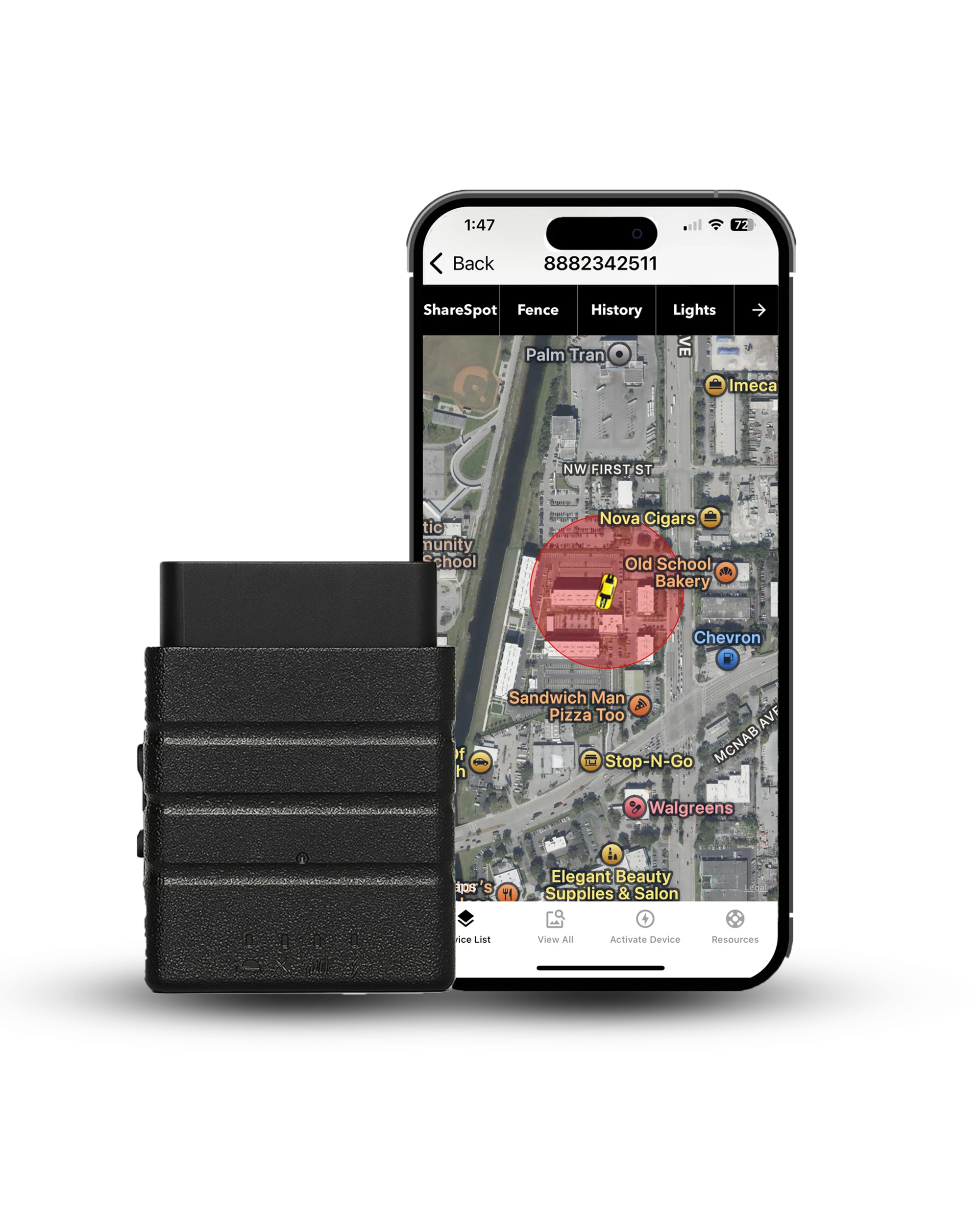
 Buy on Amazon