
Best Handheld GPS for Hiking & Backpacking (2026)
Key Takeaways
-
01Garmin GPSMAP 67i is the best all-around handheld for hikers
-
02Handheld GPS keeps working with zero cell signal or towers
-
03Battery life ranges from 16 hours to 1,800 hours by model
-
04Multi-band models hold a signal better in canyons and trees
-
05Satellite messengers add SOS calls where phones get no bars
As an Amazon Associate, Konnect GPS earns from qualifying purchases.
Best Handheld GPS for Hiking & Backpacking (2026)
Getting lost on a trail with no cell signal is more than an inconvenience. It's the moment a phone app stops being useful, since a dead battery or a "no service" bar can't call for help or show you the way back. Hikers who spend real time in the backcountry eventually run into this same problem: the tool that works fine on a day hike near town isn't the tool you want to be holding twelve miles past the last cell tower.
I'm Ryan Horban, a GPS tracking expert with more than 15 years of hands-on experience working with GPS hardware, satellite technology, and the everyday people who rely on it, from parents tracking a teen driver to fleet managers running a dozen trucks. That background is exactly why buyers ask me the same question about handheld GPS units: which one is actually worth carrying, and which one is a marketing spec sheet dressed up as a hiking essential.
In this guide, I compare the handheld GPS units that are genuinely available to buy right now, across every brand still making them, not just one company's lineup. That includes where a budget non-Garmin option earns its place and where it falls short, since a fair comparison has to say so either way.
There's no single "best handheld GPS for hiking" that fits everyone, but the right pick depends on one main trade-off: navigation plus satellite SOS in one device, or a lighter, cheaper unit that skips satellite messaging entirely. The Garmin GPSMAP 67i currently leads for hikers who want both mapping and emergency satellite communication in one rugged unit, at roughly $599.99 with up to 165 hours of battery life. Hikers who only want a lightweight satellite safety backup should look at the Garmin inReach Mini 2 instead. Budget-focused hikers who don't need satellite messaging at all can get a genuinely capable unit, either the Garmin eTrex SE or the non-Garmin NiesahYan A6, for well under $200.
A Note on Brands Before the Comparison
One thing worth being upfront about: Konnect doesn't make or sell handheld GPS units for hiking. Our own hardware is built for tracking vehicles and fleets, not trails. That means there's no house product to steer you toward here, just 15 years of GPS industry experience put to use helping you find the right pick for your next trip into the backcountry.
An honest guide has to say this plainly: Garmin is not the only brand mentioned here because of bias, it's because Garmin makes almost every handheld GPS still sold new for hiking in 2026. Magellan, once Garmin's biggest competitor in this category, discontinued its entire explorist handheld line years ago, and those units are only available used or on resale sites now, with no ongoing map or software support. The one real, currently-sold alternative brand is a lower-cost, generic manufacturer covered below. If that changes, this guide will be updated to reflect it.
How We Compared These Devices

Every device below was compared using the same checks, drawn from the manufacturer's own published specifications cross-referenced against multiple independent field reviews and verified owner-reported results, not a single trip or a single reviewer's opinion:
- Positioning accuracy. Multi-band GNSS units (using GPS plus Galileo, GLONASS, BeiDou, and QZSS together) are independently documented holding accuracy within about 6 feet in canyons and dense tree cover, where single-band units are documented drifting further off course in the same conditions.
- Battery life, real-world versus rated. Manufacturer battery claims were checked against independent multi-day field tests where available, since rated hours and real hours often differ once tracking interval, screen use, and temperature are factored in.
- Signal reliability with no cell service. All GPS positioning on every device here works with zero cell signal, since GPS relies on satellites, not towers. Only satellite messaging features need an active satellite subscription plan.
- Build and control durability. Waterproof ratings and button versus touchscreen operation were checked against manufacturer certification data (IPX7 ratings, MIL-STD-810 where claimed), since glove-friendly buttons matter more in real trail conditions than in a showroom.
- True cost, not sticker price. Devices with required satellite subscriptions were compared on hardware cost plus their published subscription pricing, not hardware price alone.
How These Handheld GPS Units Compare
| Device | Brand | Best For | Price | Battery Life | Satellite SOS | Onboard Maps |
|---|---|---|---|---|---|---|
| Garmin GPSMAP 67i | Garmin | Navigation + SOS in one device | ~$599.99 | Up to 165 hrs (tracking), 425 hrs (expedition) | Yes, subscription required | Yes, TopoActive |
| Garmin inReach Mini 2 | Garmin | Lightest satellite messenger | ~$354.99 | Up to 14 days (30-day power save) | Yes, subscription required | No |
| Garmin GPSMAP 65s | Garmin | Multi-band accuracy on AA batteries | ~$354.99 | Up to 16 hrs (35 hrs expedition) | No | Yes, TopoActive |
| Garmin eTrex 32x | Garmin | Compass and altimeter, mid-range | ~$229.99 | Up to 25 hrs | No | Yes, TopoActive |
| Garmin eTrex SE | Garmin | Longest AA battery life, budget | ~$149.99 | Up to 168 hrs (1,800 hrs expedition) | No | Basemap only |
| NiesahYan A6 | NiesahYan (non-Garmin) | Lowest-cost multi-GNSS option | ~$150-$200 | Up to 20 hrs (rechargeable) | No | Basemap only |
Prices shift often on Amazon, so check the current listing before buying. These are approximate prices as of mid-2026.
Garmin GPSMAP 67i
Navigation + Satellite SOS in One
- Multi-band GNSS accuracy down to about 6 feet
- Two-way satellite messaging and interactive SOS via Garmin Response
- Up to 165 hrs tracking, 425 hrs expedition mode
The GPSMAP 67i is Garmin's flagship hiking handheld, and it earns that spot by doing two jobs well instead of one job perfectly. It's a full GPS navigator with preloaded, routable TopoActive maps, and it's also a two-way satellite communicator built on Garmin's inReach network, which runs on the Iridium satellite system for genuinely global coverage.
Key Features
- Multi-band GNSS support (GPS, GLONASS, Galileo, QZSS, BeiDou, IRNSS) for accuracy down to about 6 feet, even in canyons and heavy tree cover
- Two-way satellite messaging and interactive SOS through Garmin Response, a staffed 24/7 emergency center
- Up to 165 hours of battery life with 10-minute tracking, or up to 425 hours in expedition mode
- USB-C charging, a change from the older 66i's micro-USB port
- Preloaded TopoActive maps plus support for downloaded satellite imagery
- Built to military standard 810 for shock, water, and temperature resistance
Pros
- Combines full navigation and SOS messaging so you're not carrying two devices
- Multi-band GPS holds a lock in places that trip up older single-band units
- Battery life is long enough for most multi-day trips without a recharge
- Physical buttons work with gloves on, which a touchscreen phone can't match
Cons
- At roughly $600, it costs more than most other options on this list
- Requires an active inReach satellite subscription plan to use messaging and SOS
- The screen shows no exact battery percentage unless it's plugged in or paired with the Explore app
Who it's for: Hikers and backpackers who want one device that handles both trail navigation and emergency communication, and who take enough multi-day trips to justify the higher price and the subscription cost.
Garmin inReach Mini 2
Best Lightweight Satellite Messenger
- Two-way text messaging and interactive SOS over Iridium
- Battery life up to 14 days, 30 at power-save interval
- Weighs only 3.5 ounces
If your phone already handles navigation just fine and what you actually want is a safety net for places with no signal, the inReach Mini 2 is built exactly for that. It skips onboard topo maps entirely and focuses on one job: keeping you connected to help no matter where you are.
Key Features
- Two-way text messaging and interactive SOS over the Iridium satellite network
- Battery life up to 14 days at the default 10-minute tracking interval, and up to 30 days at a 30-minute interval
- Weighs only 3.5 ounces, small enough to clip to a shoulder strap
- Digital compass and a breadcrumb trail feature to retrace your route
- Pairs with the free Garmin Messenger app for easier typing and message threads
Pros
- Among the lightest satellite communicators available, easy to carry on any trip
- Battery life is measured in days, not hours, which matters on long thru-hikes
- Works completely independent of cell coverage anywhere on Earth
Cons
- No onboard maps, so it's a communication device, not a full navigator
- Requires a separate satellite subscription plan on top of the hardware cost
- Sending a full message from the device itself is slower than typing on a phone; most people pair it with the Messenger app instead
- Battery life drops noticeably in heavy tree cover compared to open sky, since satellite transmissions take more power under cover
Who it's for: Hikers who already navigate with a phone, watch, or paper map and want the lightest possible safety backup for messaging and SOS.
Garmin GPSMAP 65s
Best Multi-Band Accuracy on AA Batteries
- Multi-band GNSS accuracy without a subscription
- Built-in altimeter, barometer, and 3-axis compass
- Up to 16 hrs standard, 35 hrs expedition, on 2 AA batteries
The 65s brings the same multi-band GNSS accuracy found in the 67i to a smaller, AA-powered body with no satellite subscription required. It's built for hikers who want strong positioning in tough terrain without paying for ongoing messaging service.
Key Features
- Multi-band GNSS support across GPS, GLONASS, Galileo, and QZSS for accuracy that holds up under tree canopy and in canyons
- Built-in altimeter, barometer, and 3-axis compass
- Up to 16 hours of battery life in standard GPS mode, or up to 35 hours in expedition mode, on two AA batteries
- 2.6-inch sunlight-readable color display, one of the largest screens in this size class
- Preloaded TopoActive maps with a microSD slot for adding more
Pros
- Multi-band accuracy without needing an ongoing satellite subscription
- AA batteries are easy to swap in the field with no charger needed
- Larger screen than the eTrex line makes maps easier to read at a glance
Cons
- No built-in satellite messaging or SOS, unlike the 67i or inReach Mini 2
- 16-hour standard battery life is short next to AA-powered eTrex models
- Still uses an older mini-USB connector instead of USB-C
Who it's for: Hikers who want serious GPS accuracy in difficult terrain but don't need satellite messaging, and who prefer AA batteries over a rechargeable pack.
Garmin eTrex 32x
Best Mid-Range With Compass and Altimeter
- Routable TopoActive maps preloaded
- 3-axis compass and barometric altimeter
- Up to 25 hrs on 2 AA batteries
The eTrex 32x sits in the middle of Garmin's lineup: more capable than the base eTrex SE, but simpler and less expensive than the GPSMAP line. It's a dependable, no-frills GPS for hikers who want a few extra field tools without the higher price of a multi-band unit.
Key Features
- 2.2-inch sunlight-readable color display with routable TopoActive maps preloaded
- 3-axis compass and barometric altimeter for heading and elevation data
- Up to 25 hours of battery life on two AA batteries, with lithium batteries often stretching that further
- 8 GB of internal memory plus a microSD card slot for extra maps
- GPS and GLONASS satellite support, though not full multi-band
Pros
- AA batteries are easy to find and replace almost anywhere, including a gas station
- Compass and altimeter add real trail value over a basic GPS-only unit
- Simple, stable software that has stayed largely unchanged for years
Cons
- No multi-band GNSS, so accuracy in dense forest lags behind the 65s or 67i
- Interface feels dated compared to newer touchscreen options
- 8 GB of onboard memory fills up fast once topo maps are loaded, so a microSD card is close to mandatory for extra data
Who it's for: Hikers who want a dependable mid-range GPS with a compass and altimeter, and who are fine trading some accuracy for a lower price than the multi-band models.
Garmin eTrex SE
Best Budget Handheld GPS
- Multi-GNSS support across 5 satellite systems
- Up to 168 hrs standard, 1,800 hrs expedition mode
- Bluetooth pairing with the Garmin Explore app
The eTrex SE replaced the long-running eTrex 10 and brought real upgrades: multi-GNSS support, Bluetooth pairing, and dramatically longer battery life, all at one of the lowest prices in Garmin's handheld lineup.
Key Features
- Multi-GNSS support across GPS, GLONASS, Galileo, BeiDou, and QZSS for a faster position fix than GPS alone
- Up to 168 hours of battery life in standard mode, and up to 1,800 hours in expedition mode, on two AA batteries
- Digital compass that reads an accurate heading even while standing still
- Bluetooth pairing with the Garmin Explore app for weather updates and Geocaching Live
- IPX7 water-resistant rating and a 2.2-inch sunlight-readable screen
Pros
- Longest realistic battery life on this list by a wide margin
- One of the most affordable Garmin handhelds with real multi-GNSS support
- Simple enough for a first-time buyer, rugged enough for regular trail use
Cons
- No preloaded topo maps, just a basic map, so trail detail is limited without pairing to the Explore app
- Monochrome-style basic display compared to the colour topo screens on pricier models
- No satellite messaging or SOS feature
Who it's for: Budget-conscious hikers who want a reliable backup GPS with excellent battery life, and who are comfortable using it alongside a phone or paper map for detailed trail info.
NiesahYan A6
Lowest-Cost Non-Garmin Option
- Multi-GNSS support, accuracy listed under 5 feet
- Rechargeable battery, up to 20 hrs continuous use
- Waypoint and track navigation for up to 1,000 points
The A6 is the most realistic non-Garmin alternative currently sold for hiking, and it deserves a fair, honest look rather than being dismissed just for coming from a smaller manufacturer. It covers the basics of standalone GPS navigation at a lower price than most Garmin units, though it gives up the mapping depth and brand track record that come with a more established line.
Key Features
- Multi-GNSS support across GPS, QZSS, BeiDou, and GLONASS for position accuracy the manufacturer lists as under 5 feet
- 2.4-inch sunlight-readable color display with button controls
- Rechargeable battery rated up to 20 hours of continuous use, charged over USB-C
- Waypoint and track navigation for up to 1,000 saved coordinate points
- Built-in compass, altimeter, and sunrise/sunset and moon phase data
Pros
- Meaningfully cheaper than any Garmin model on this list
- Genuine multi-satellite support, not just basic single-band GPS
- Rechargeable battery avoids the ongoing cost of AA batteries
Cons
- No preloaded topo maps, only a basic reference map, so trail detail is limited
- No satellite messaging or SOS feature of any kind
- A newer, less established manufacturer than Garmin, with a shorter track record and no equivalent long-term software or map support
- 20-hour battery life is short next to AA-powered Garmin units built for multi-day trips
Who it's for: Hikers on a tight budget who want basic standalone positioning as a backup to a phone, and who don't need detailed topo maps or any satellite safety feature.
Handheld GPS vs. Your Phone: What Actually Changes

This is the question most buying guides skip. A modern smartphone has a genuinely good GPS chip. The differences that matter come down to three things.
Battery drain. A phone's GPS chip is one small piece of a device also running a screen, apps, and a cell radio searching for towers that aren't there. A dedicated handheld only powers a screen and a GPS chip, which is why a $125 eTrex SE gets a week of battery life a $1,000 phone can't touch.
No-signal communication. Your phone's GPS still works with zero bars, since GPS doesn't need a cell connection. What a phone can't do without a separate satellite plan is call for help. That gap is exactly what inReach-enabled devices are built to close.
Durability in real conditions. Cold weather drains lithium phone batteries fast, and a touchscreen is harder to use with wet gloves than a raised physical button. None of this makes a phone a bad hiking tool. It just explains why serious backcountry hikers usually carry both.
One of the hardest hikes I've ever done was the Trans-Catalina Trail back in 2020. The trail itself isn't especially technical, but I went right after a week of downpours, and the whole route had turned to mud. I was slipping and sliding the entire way. It rained through all three days too, so I couldn't even get a campfire going — just cold, wet, and muddy the whole trip. That kind of trip tells you fast whether your gear can actually take a beating, GPS included.


What Actually Drains Handheld GPS Battery Life

Every battery life number on a spec sheet is a best case. A few settings make the biggest real-world difference:
Tracking interval
Checking your position every 10 minutes uses far less power than continuous tracking, and stretches battery life by days on satellite messengers.
Tree cover and terrain
Devices with satellite messaging use more power finding a signal under heavy canopy or in canyons, since the antenna has to work harder.
Screen backlight settings
A shorter backlight timeout is one of the simplest ways to add hours to any handheld's runtime.
Battery type in cold weather
Alkaline AA batteries lose capacity fast in freezing temperatures. Lithium AAs hold up much better below freezing.
Which Handheld GPS Fits Your Kind of Hiking

Multi-day backpacking or thru-hiking: The GPSMAP 67i or the inReach Mini 2 make sense here, since both give you satellite messaging for remote stretches with no cell signal.
Day hikes on marked trails: An eTrex SE or eTrex 32x is plenty. You're rarely far enough from help to need satellite SOS, and the lower price and long battery life fit casual use better.
If you're hiking with little ones and want a trail that feels like a reward instead of a slog, Lithia Park in Ashland, Oregon is one of my favorites. Deer wandering near the path, quiet ponds, and a real burst of color depending on the season. I try to bring my family back roughly every five years, and we're actually headed there again next month.


Hunting or off-trail navigation in dense terrain: The GPSMAP 65s or 67i's multi-band GNSS holds a signal better under tree cover and in canyons than single-band units.
Ultralight backpacking: The inReach Mini 2 is the lightest option here by a wide margin, at 3.5 ounces, if you're already navigating by phone or watch.
Final Thoughts
There isn't one right handheld GPS for every hiker, and any guide that tells you otherwise is skipping the real decision. The GPSMAP 67i is the strongest pick if you want navigation and emergency satellite communication in a single rugged device, and you're willing to pay for both the hardware and the subscription. The inReach Mini 2 is the better call if your phone already handles maps and you just want the lightest possible safety net. The GPSMAP 65s and eTrex 32x sit in the middle for hikers who want strong accuracy or useful field sensors without paying for satellite messaging. The eTrex SE is the simplest, longest-lasting, and most affordable way to add a real backup GPS from an established brand. The NiesahYan A6 fills a real gap below that price, for hikers who want basic standalone positioning and are fine without topo maps or satellite SOS.
None of these is "best" in isolation. Match the device to whether you need satellite messaging, how many days you're out at a time, and what you're willing to pay, and the right pick becomes clear fast.
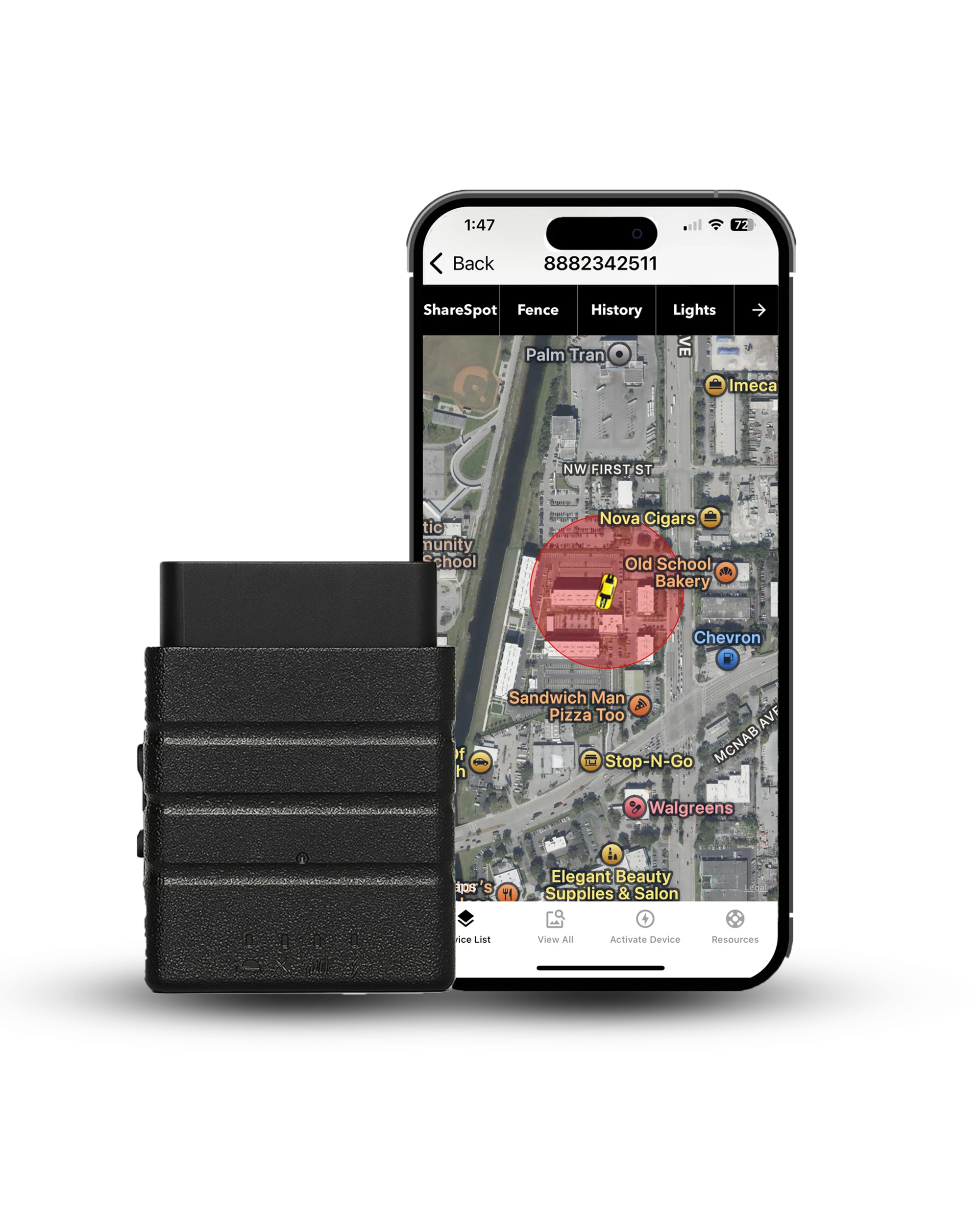
Tracking a vehicle instead of a trail?
Konnect OBD2 plugs straight into your car's OBD2 port and delivers 3-second real-time updates, geofencing alerts, and reliable coverage across 150+ countries — no batteries to swap, with a free first year of service.
About the Author

 Buy on Amazon